See more.
Know sooner.
Non-destructive concrete scanning, LiDAR, and NDT surveys — across the UK, results the next working day.
Google ReviewsSix specialist services. One accountable team.
From a single scan to a full investigation programme — measured information your engineers and building owners can act on.
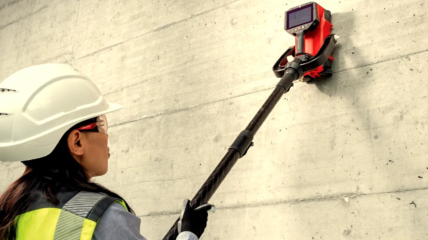
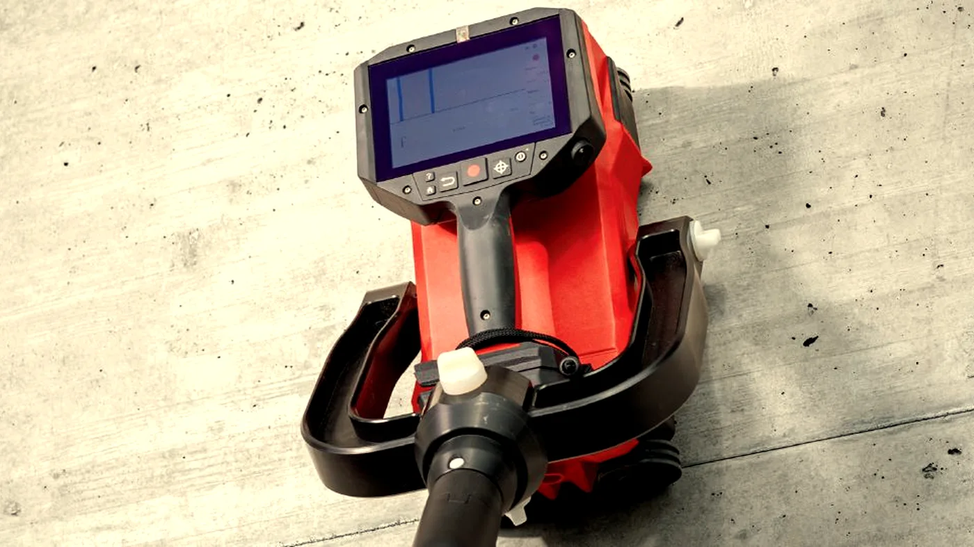
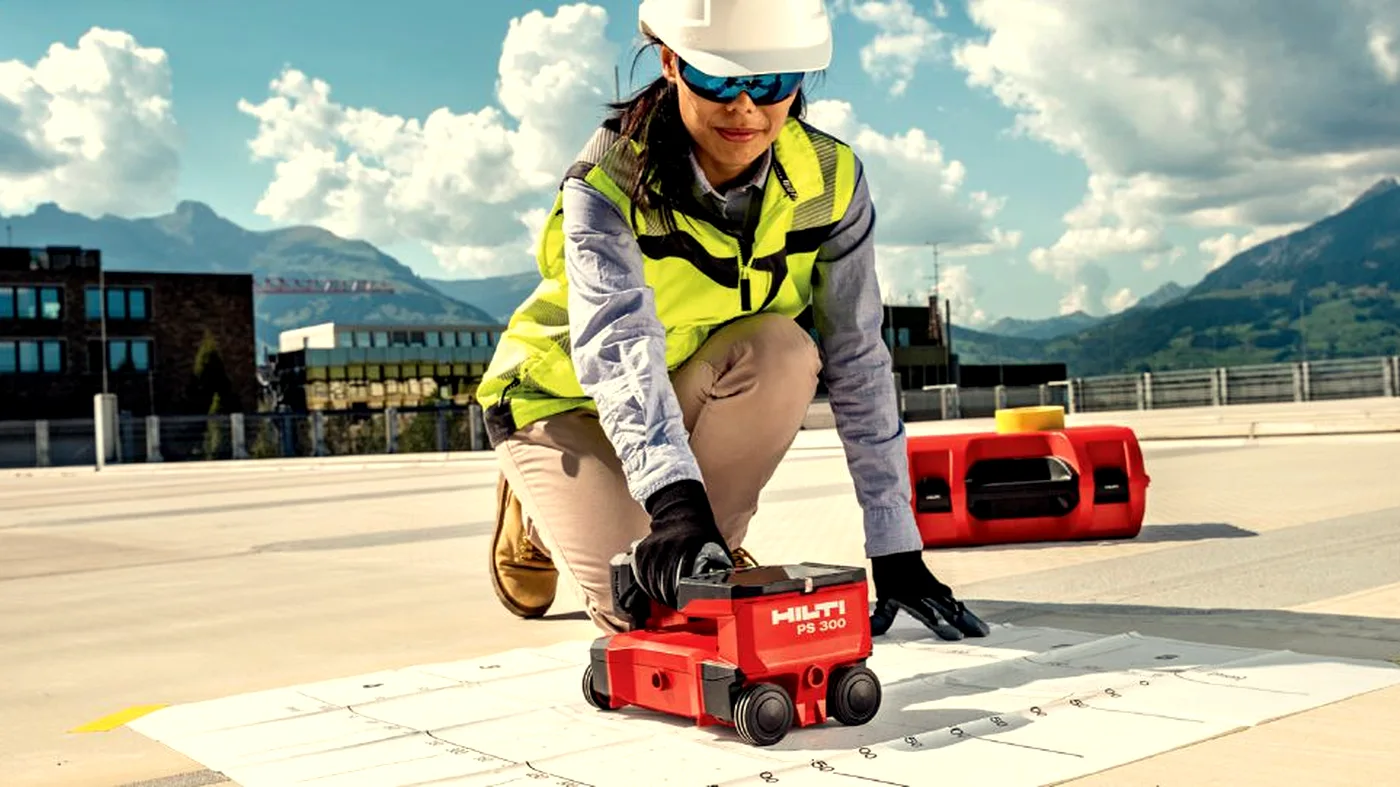
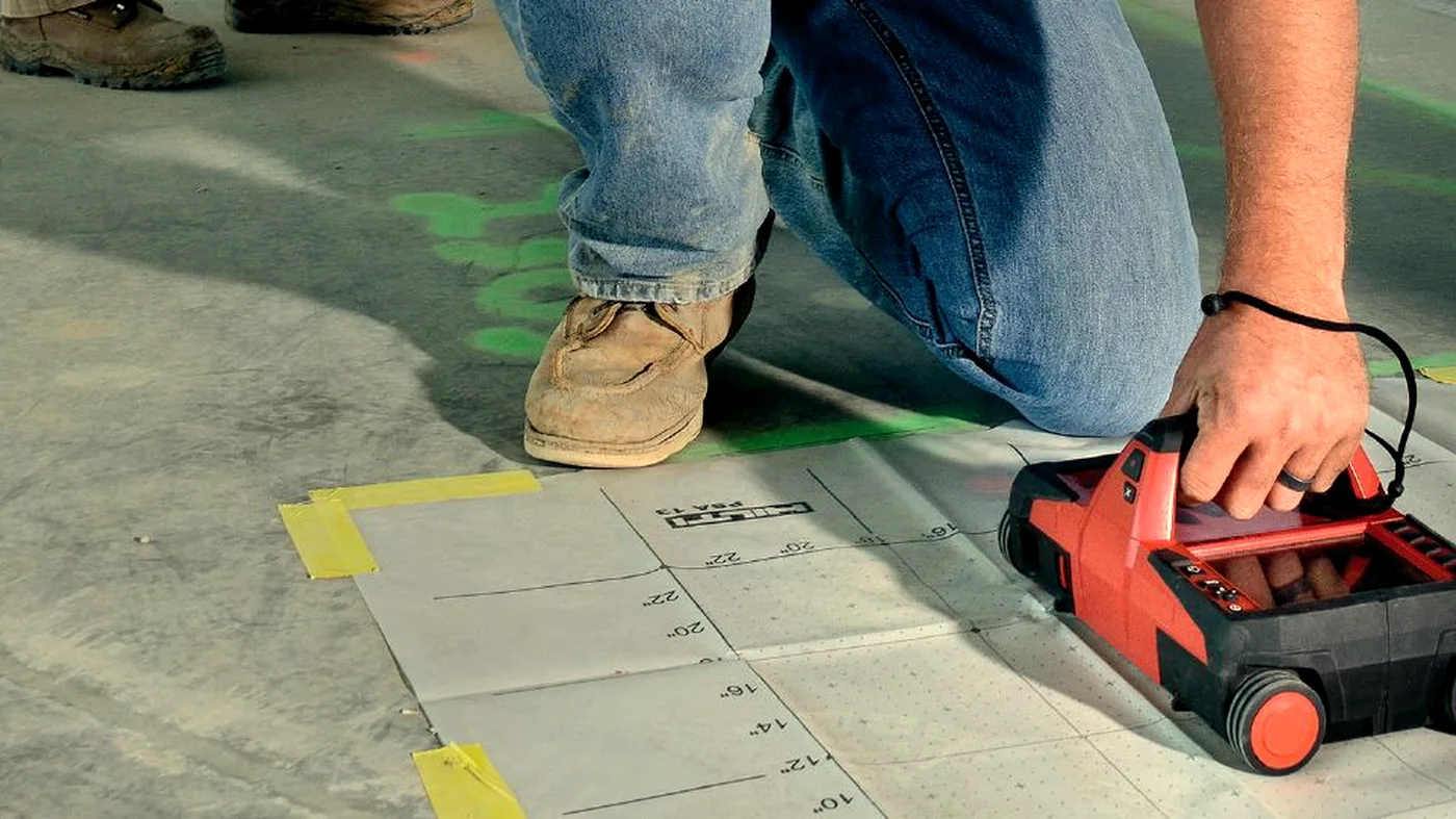
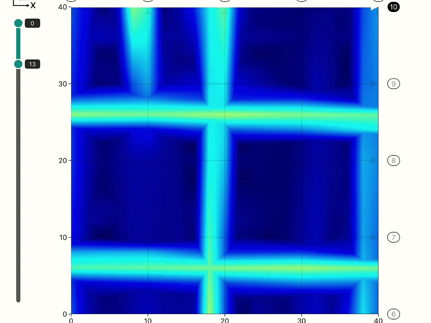
GPR Concrete Scanning
Ground penetrating radar finds rebar, post-tension cables, conduits, and voids hidden inside concrete — before they become a problem.
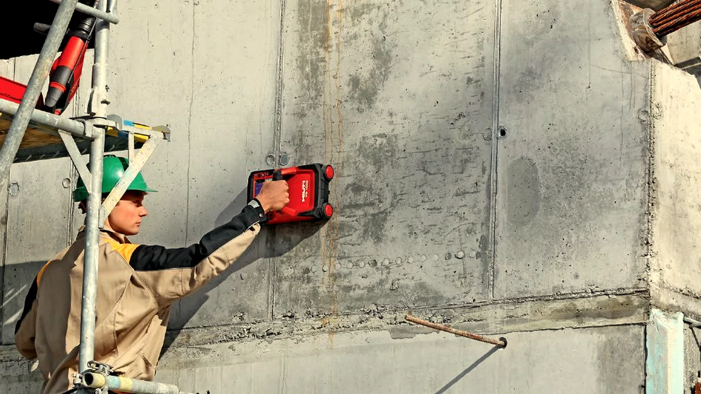
Learn moreFerro Scanning
Electromagnetic scanning to map reinforcement, measure cover depth, and estimate bar diameter without touching the concrete.
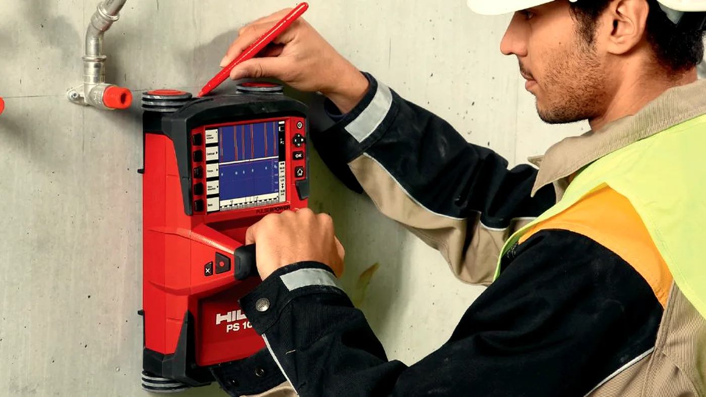
Learn moreConcrete Testing
On-site non-destructive and intrusive testing methods, including rebound hammer testing, pull-out testing, core extraction, and laboratory compressive strength testing.
Learn moreLiDAR Scanning
Terrestrial and mobile LiDAR for as-built surveys, façade capture, structural monitoring, and BIM-ready point clouds.
Learn moreDrone Surveys
Drone surveys for site progress, photogrammetry, orthomosaics, aerial inspection, and volumetrics. Subject to CAA Operational Authorisation.
Learn moreLarge-Scale GPR
Multi-channel and array GPR for utility mapping, highways, airfields, archaeology, and ground investigation.
Learn moreMore than a scan.
Every investigation combines calibrated survey equipment with experienced interpretation and structured reporting — turning raw scan data into engineer-ready information you can act on with confidence.
Calibrated equipment
Survey kit calibrated and verified before every job, so readings hold up to scrutiny.
Expert interpretation
Geophysics-trained surveyors interpret the radar; the reading is only as good as the person reading it.
Proprietary software
Our own interpretation tools convert raw returns into clear, marked-up findings.
AI-assisted reporting
Structured reporting turns findings into engineer-ready outputs, faster.
Engineering-grade detail. Delivered when you need it.
We scan, test and survey reinforced concrete and the built environment — then hand your engineer clear, defensible information to act on. No guesswork, no drilling blind.
- 2 HR
- Response to urgent requests
- NEXT DAY
- Reports, as standard
- UK-WIDE
- Nationwide coverage
Built for sectors that don't tolerate guesswork.
From phone call to deliverable in four steps.
- 1
Call
Same-day quote. Tell us the site, the structure and the programme.
- 2
Attend
We attend fast — planned around live works and occupied buildings.
- 3
Investigate
GPR, Ferroscan, LiDAR and testing, tied back to your drawings.
- 4
Deliver
On-slab markup plus annotated PDF and DXF / DWG — engineer-ready.
Real surveys. Real sites.
Real jobs. Real data.
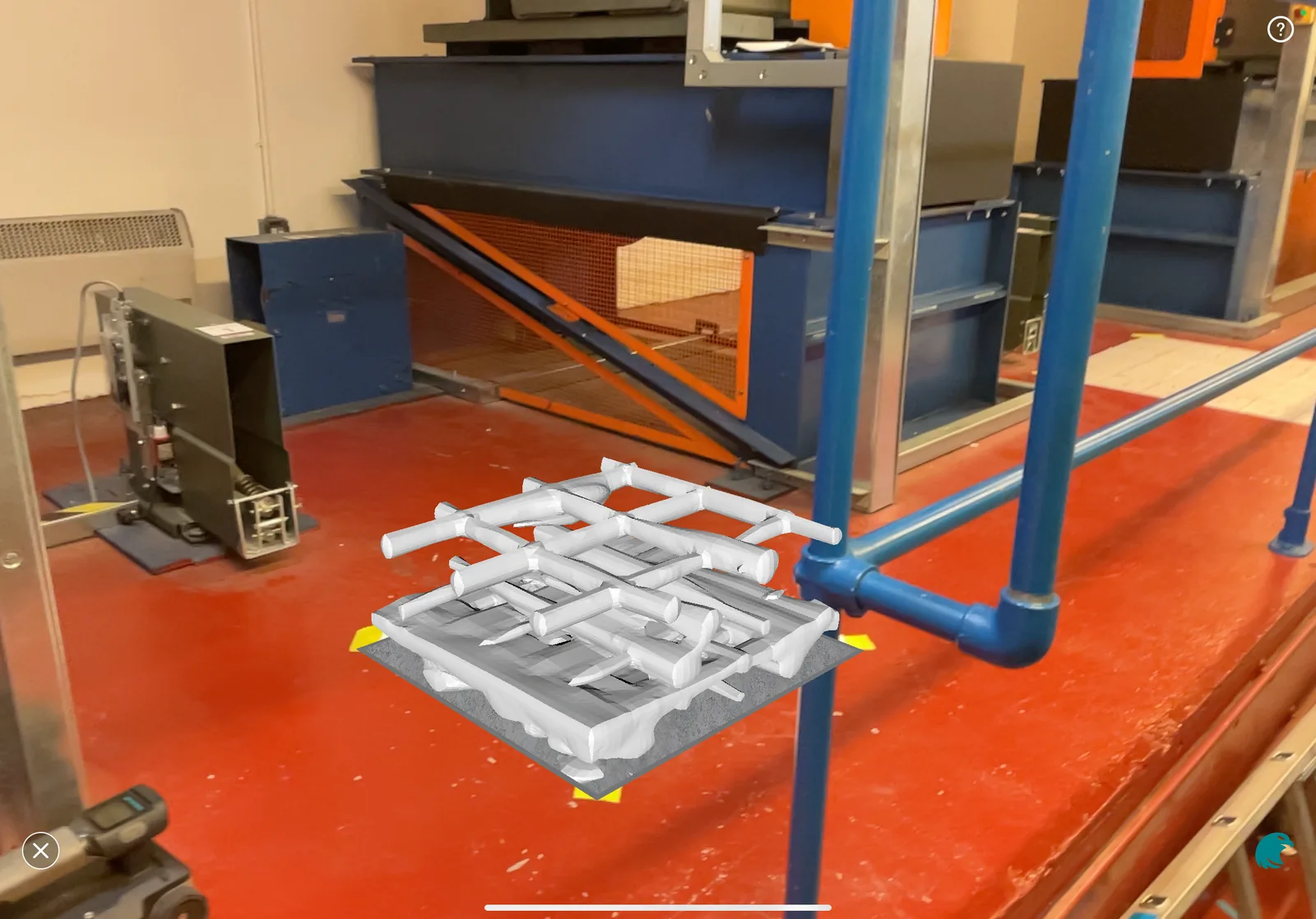
Proving a machine-room slab for new lift motors
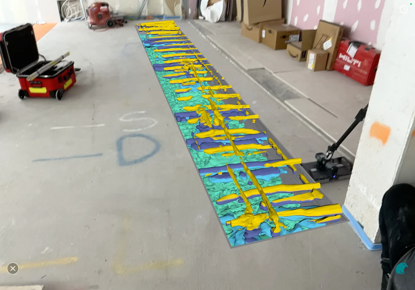
A City of London office was replacing its lift motors with new, smaller units. Before the machine-room slab could be signed off to carry them, Corvus mapped its reinforcement with GPR and Ferroscan — and rendered it in 3D over the slab — so the engineer could verify it on evidence, not assumption.
View case study Proving a lift pit base for a hydraulic ram
A new hydraulic lift at a St Neots waterfront bar seats its ram in the pit — putting the whole load on the pit base. Corvus surveyed the pit slab and walls with GPR to locate the reinforcement and prove the base before installation, so the ram load could be signed off without drilling blind into a critical floor.
View case study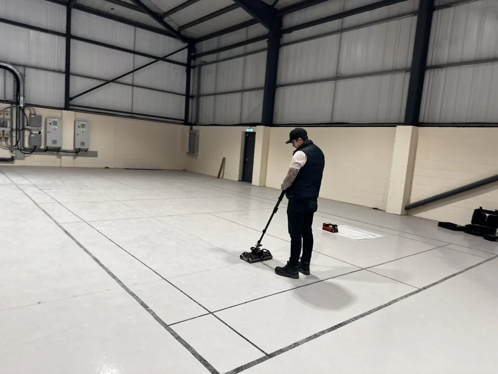
Scanning a suspended slab so a data centre could build up
Custodian Data Centres needed to add a mezzanine over a suspended, pile-supported slab. Corvus mapped the reinforcement with large-format GPR and Ferroscan so the structural engineer could design it — without drilling blind.
View case studyWhat our clients say
Corvus were great from start to finish. Needed a quick turnaround on a concrete survey with subsequent core hole to be drilled in a sensitive area. They attended next day and delivered their survey promptly in order for our project to stay on schedule. Highly recommend.
Fantastic experience working with Connor. He provided brilliant service, was highly efficient, and made the whole process seamless. It's rare to find someone so reliable and dedicated to quality work. 10/10 would recommend.
Contacted Corvus to use GPR to locate concrete supports laid under a porcelain patio to anchor pergolas to. Within minutes Terry called to discuss and advised they could attend within a week — with an honest caveat that it might not be possible depending on the materials. Terry and Connor attended on the agreed date, on time, and were a pleasure to deal with — professional, polite, friendly and conscientious. The majority of the footings were not where the landscaping contractors had led us to believe, so a worthwhile exercise indeed. Would thoroughly recommend.
Let's talk before the next drill hits concrete.
Send drawings, photos or proposed fixing locations and we'll advise the right survey approach.